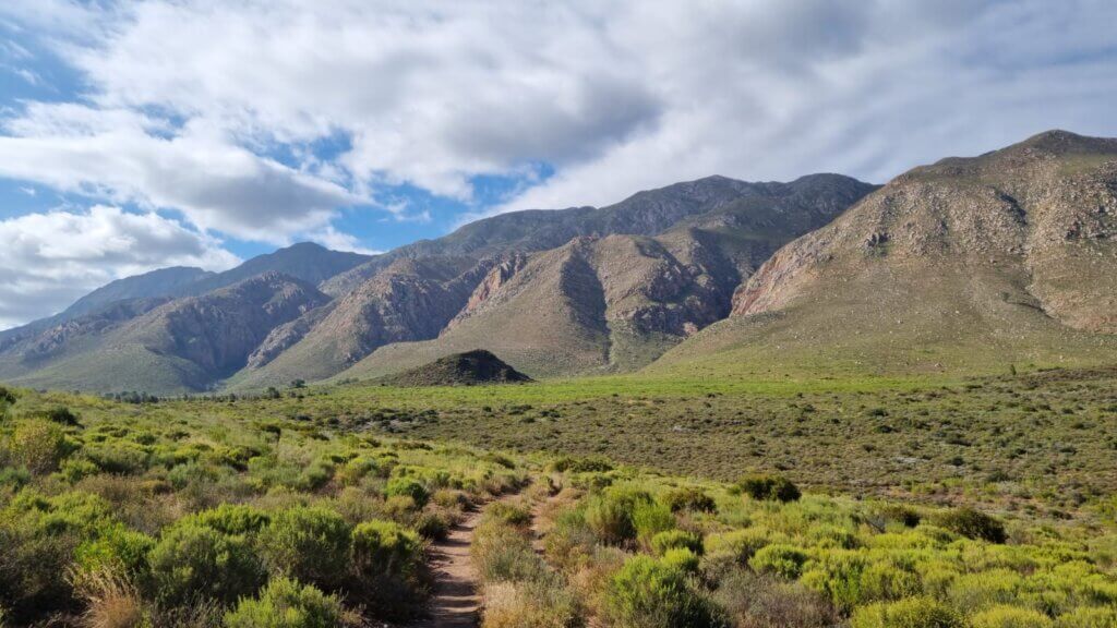
Montagu is one of the Western Cape’s premier destinations for mountain biking, gravel riding, and outdoor adventure. Nestled along the iconic Route 62 in the Langeberg mountains, Montagu offers a diverse network of MTB trails suited to beginners, families, and experienced riders alike.
Our passion lies in crafting and maintaining the very trails that weave through this mountain bicycle haven. From leisurely family-friendly rides to heart-pounding challenges that leave even the most seasoned riders grinning, we’ve got it all. Our routes are carefully graded on a scale of 1 to 5, so whether you’re seeking a scenic pedal through nature’s wonders or a hair-raising ride, we’ve got you covered.
Picture yourself basking in the glory of Montagu’s natural beauty, the wind in your hair and the freedom of the open trails at your fingertips. As the sun kisses the Karoo landscape, early mornings in summer are the sweet spot to embark on your journey and dive into an adventure that will leave you invigorated and inspired.
Join us as we carve out unforgettable experiences on two wheels. The thrill of Montagu’s trails calls out, and your next great adventure is just a pedal away.
Our mission is to build, maintain, and protect the mountain bicycle trails in Montagu, ensuring riders enjoy safe, well-marked, and unforgettable routes through this unique Karoo landscape.
From easy scenic rides perfect for families and casual cyclists, to technical singletrack and challenging climbs for advanced riders, the Montagu trail network caters to every level of experience.
All routes are graded on a 1 to 5 difficulty scale, helping you choose the right trail based on your fitness level and riding style.
Riding in Montagu is about more than just the trails, it’s about the experience.
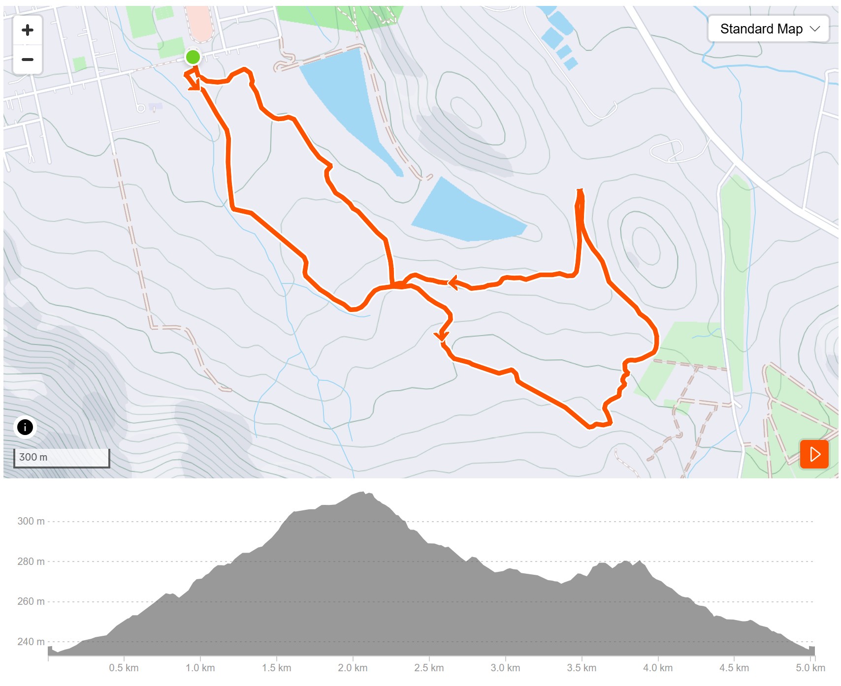
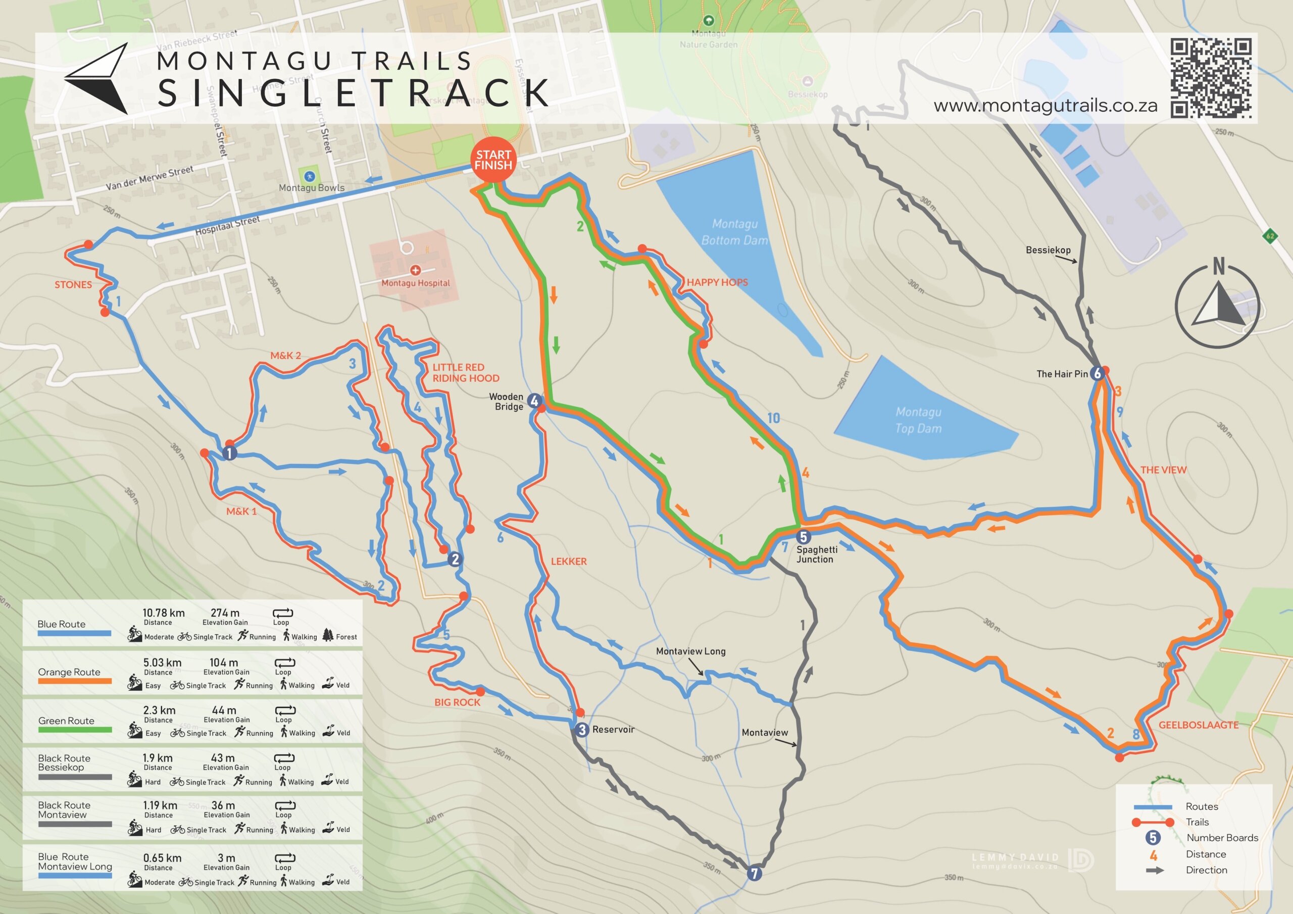
Start your adventure from the Park & Ride behind Montagu High School in Hospital Street, where a well-marked route awaits.
Follow the orange arrows as they guide you through a charming path between the houses and into the heart of nature. This gentle, well-paced trail is perfect for a time trial, a refreshing walk, a quick trail run, or a moment to reconnect with the outdoors.
Whether you’re looking for a peaceful solo escape or a fun outing with family and friends, this route offers a delightful way to explore Montagu’s natural beauty.
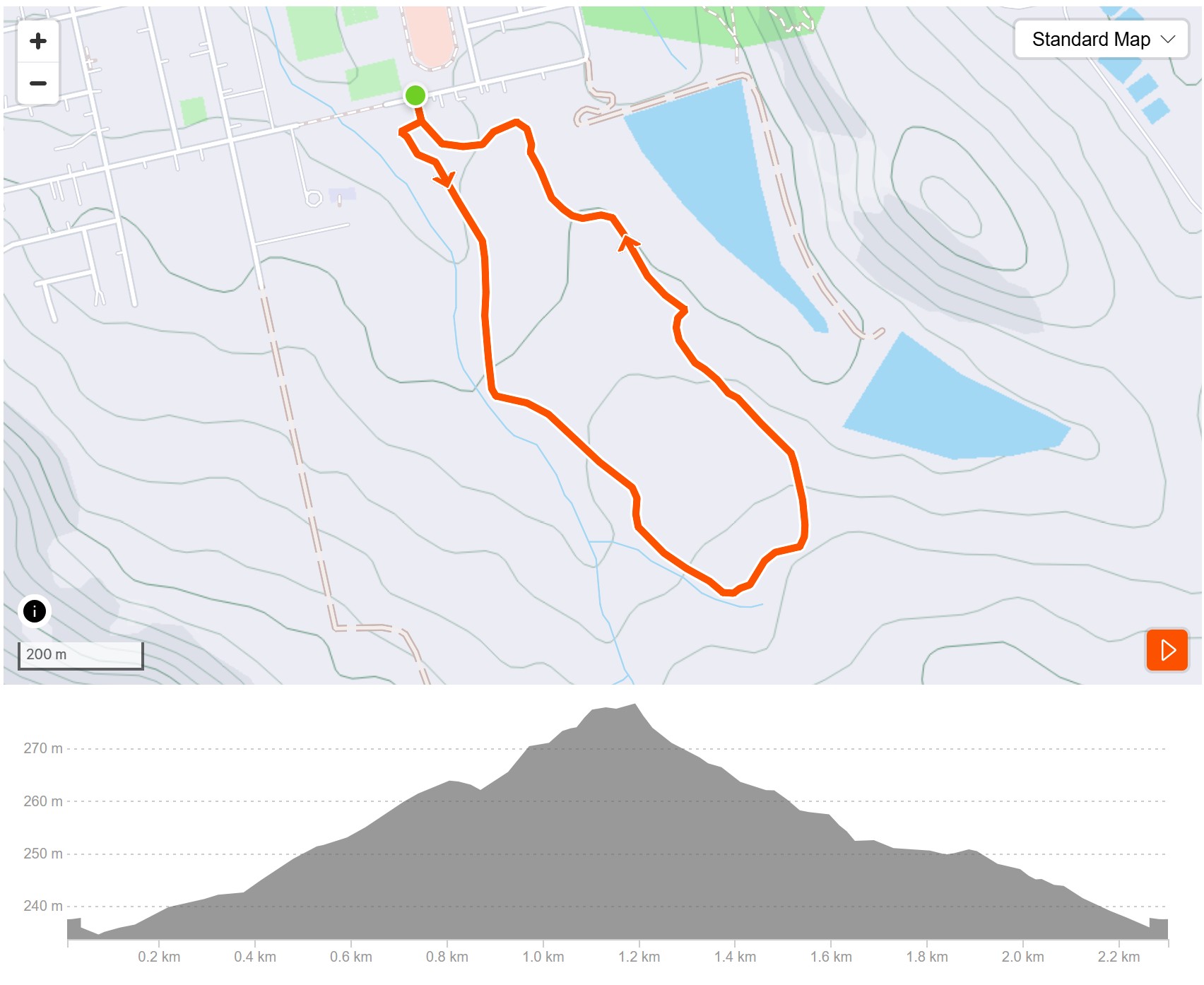
Start your adventure from the Park & Ride behind Montagu High School in Hospital Street, where a well-marked route awaits.
Follow the green arrows as they guide you through a charming path between houses and into the heart of nature. This gentle, well-paced trail is perfect for a time trial, a refreshing walk, a quick trail run or a moment to reconnect with the outdoors.
Whether you’re looking for a peaceful solo escape or a fun outing with family and friends, this route offers a delightful way to explore Montagu’s natural beauty.
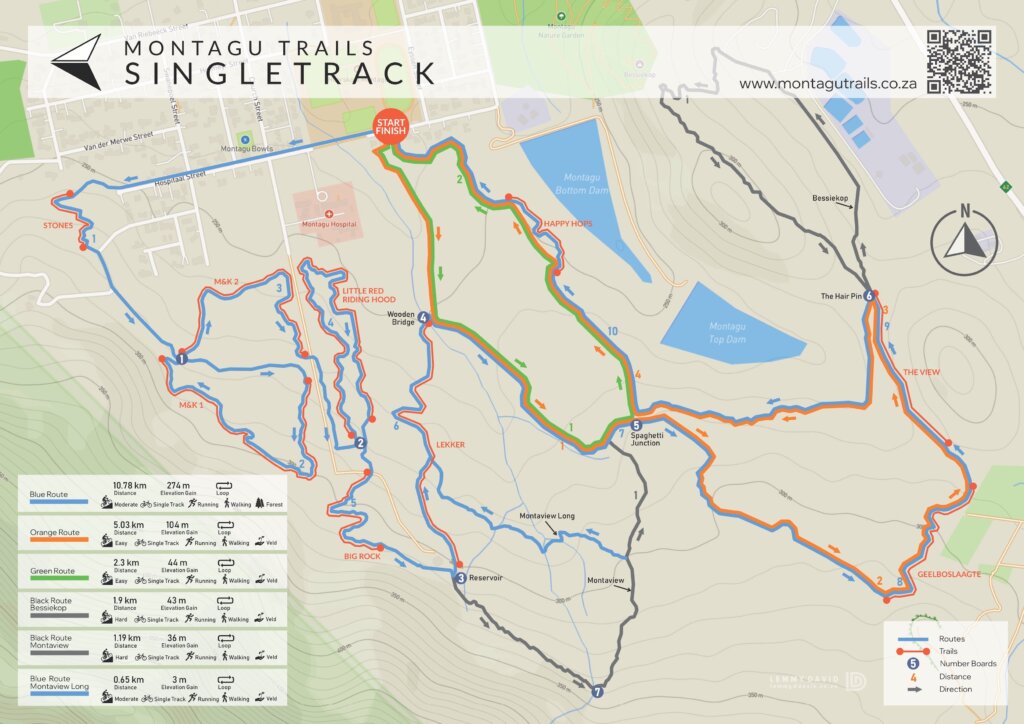
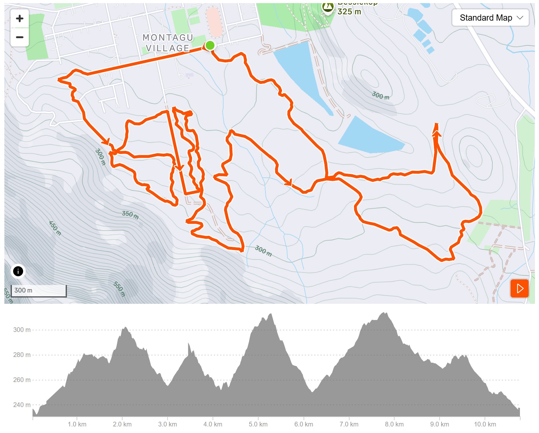
Our singletrack is located behind the hospital on the mountain side of Montagu South. There is a Park & Ride behind the Montagu High School in Hospital Street and blue arrows indicate the way.
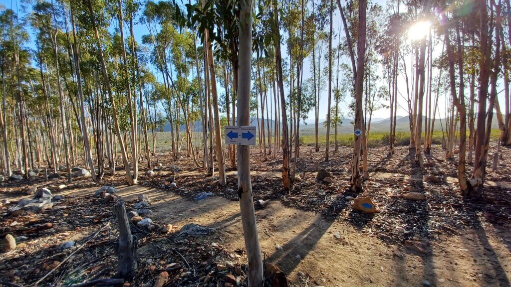
Want more distance? Start from your accommodation in town, going up Church Street turn right into Hospital Street. Enter the Sugar Gum Forest and enjoy the beauty of this area while exploring Little Red Riding Hood, M+K and Big Rock trails.
Exit the forest on a flowing downhill section and be cautious before you cross the bridge. Follow the blue arrows over the beautiful Karoo landscape.
A pump track awaits before you exit the trails. Pump track not your thing? There is an easier exit should you choose.
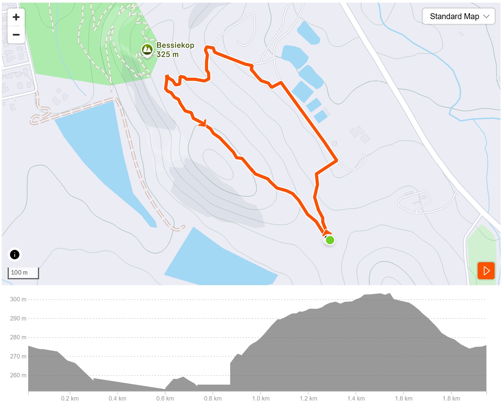
Looking for an extra challenge?
Bessiekop extends the Blue Route singletrack, adding 1.9km of exhilarating terrain to test your endurance and skill.
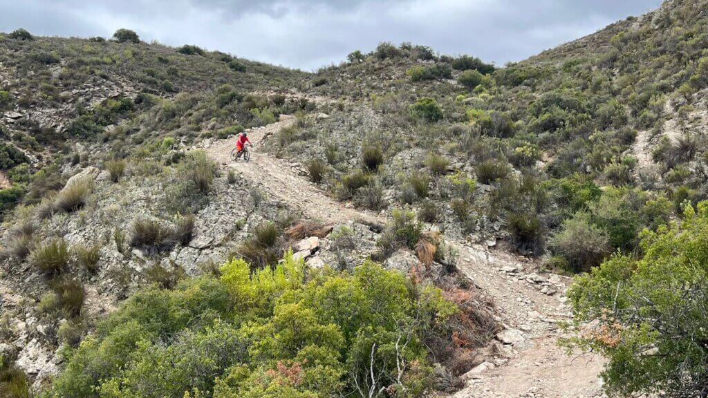
Follow the black arrows as you tackle a steep, steady climb, winding around Bessiekop’s rugged slopes and reconnecting with the Blue Route.
Get your hearts pumping, embrace the adventure, and experience Montagu’s trails at their most thrilling.
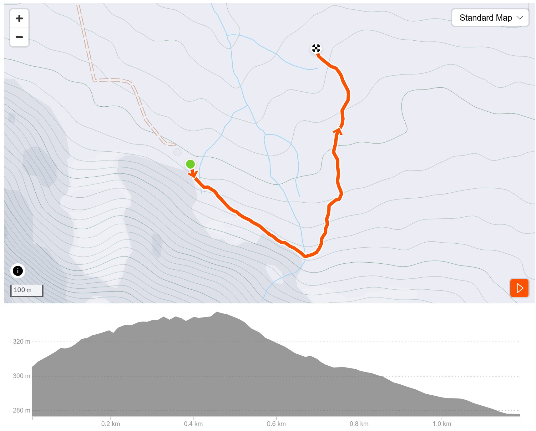
Looking for more of a challenge?
Montaview extends the Blue Route singletrack with an additional 1.1km of scenic terrain that will test your endurance and skills level.
Follow the black arrows as you navigate the steep climbs.
Take a moment to appreciate the panoramic views before the trail reconnects with the main Blue Route.
This extension increases your workout intensity while providing access to some of the most impressive scenery in the area.
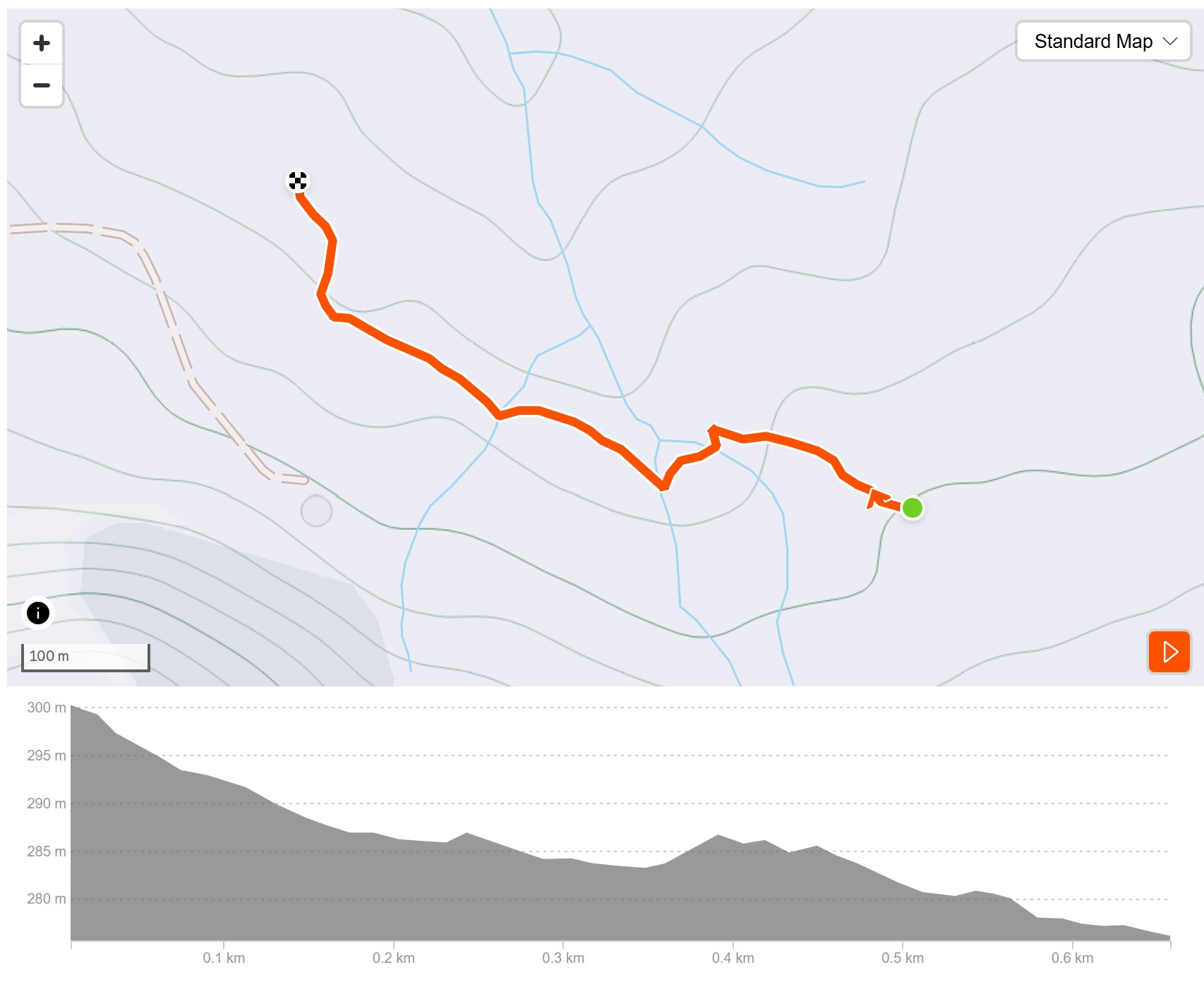
Montaview Long is a compact Blue Route that branches left midway through the Montaview descent.
This 700m trail packs in a few surprises and unexpected challenges despite its shorter length. The trail culminates in a flowing downhill section that reconnects with the main Blue Route just before you reach the wooden bridge.
Perfect for those looking to add some variety to their ride without a major time commitment. Montaview Long delivers an engaging experience that punches above its weight.

There is limited to no cellphone signal along these routes. For your safety, we strongly recommend riding with a buddy.
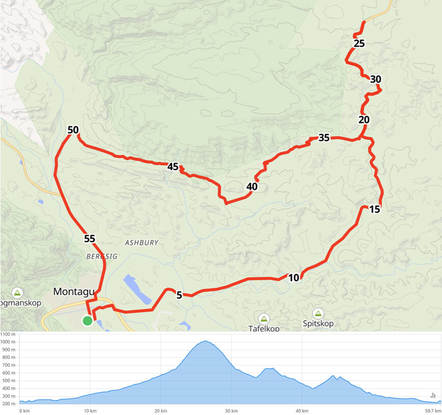
0.0 km, Proceed onto Hospitaal Street
1.5 km, Right onto Van Riebeeck Street
1.8 km, Continue on Talana Road
26.4 km, Continue on Ouberg Pass
53.4 km, Continue on Bath Street
58.2 km, Left onto Cross Street
59.8 km, Arrive at Finish
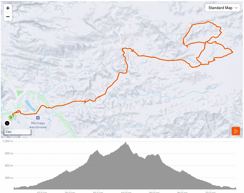
0–28 km: Public gravel road, gradual climb.
28 km: AGL Entrance
31 km: AGL Reception
31–42.7 km: Slagkloof Trail
42.7 km: AGL Reception
49 km: Eland Single Track
51 km: Exit gate (sensor activated)
28 km: Fast gravel road descent back to Montagu
R50 day permit payable at AGL Reception
By prior arrangement: Contact Monwa (+27) 73 794 3402
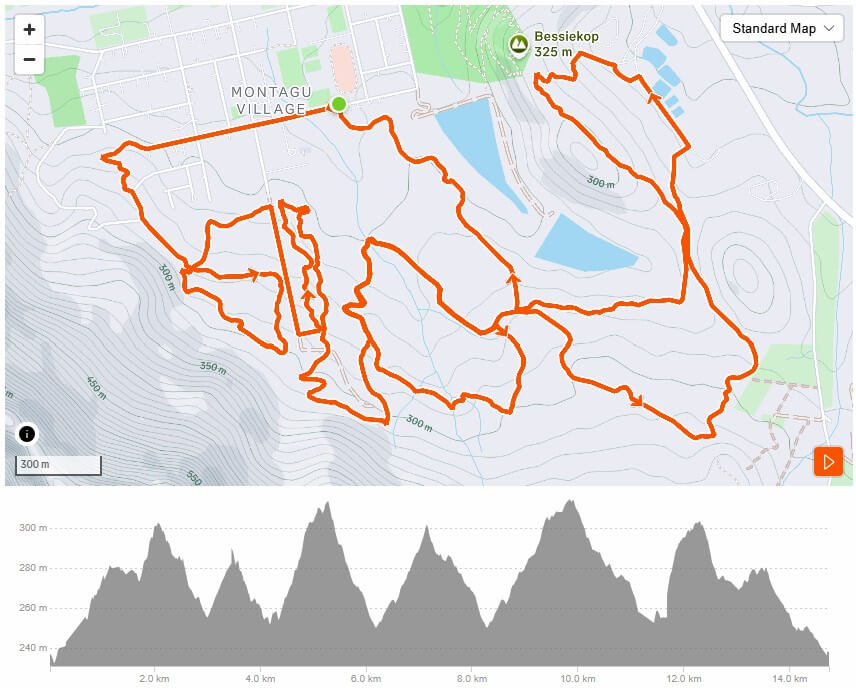
The trail starts and ends at the High School Sports Fields.
Start/Finish: S33° 47.775’ E20° 7.484’
Follow the blue direction arrows (and black arrows to include Bessieskop).
Be mindful of walkers and dogs.
No littering whatsoever!
Ride the trails in the direction indicated by the blue direction arrows.
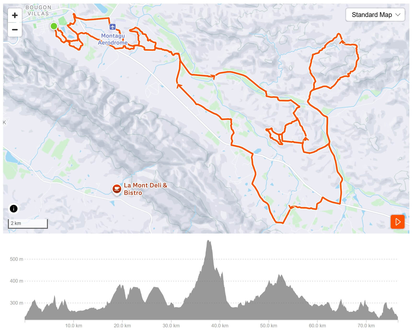
5.6 km, gate into Dooringlaagte
9.0 km, turn right onto Talana Rd
16.1 km, gate, start of the Klipkuil Trail, various options
28.0 km, gate, exit the Klipkuil Trail. The Klipkuil Trail can also be cycled in the opposite direction.
31 km, gate, start of the Koenie Kloof Trail, tough 10 km loop, 340 m ascent
36.4 km, summit, caution on the downhill section!
41 km, gate, exit the Koenie Kloof Trail
46.7 km, turn right onto the R62
R62: Leeurevier and Rietvlei options back to Montagu
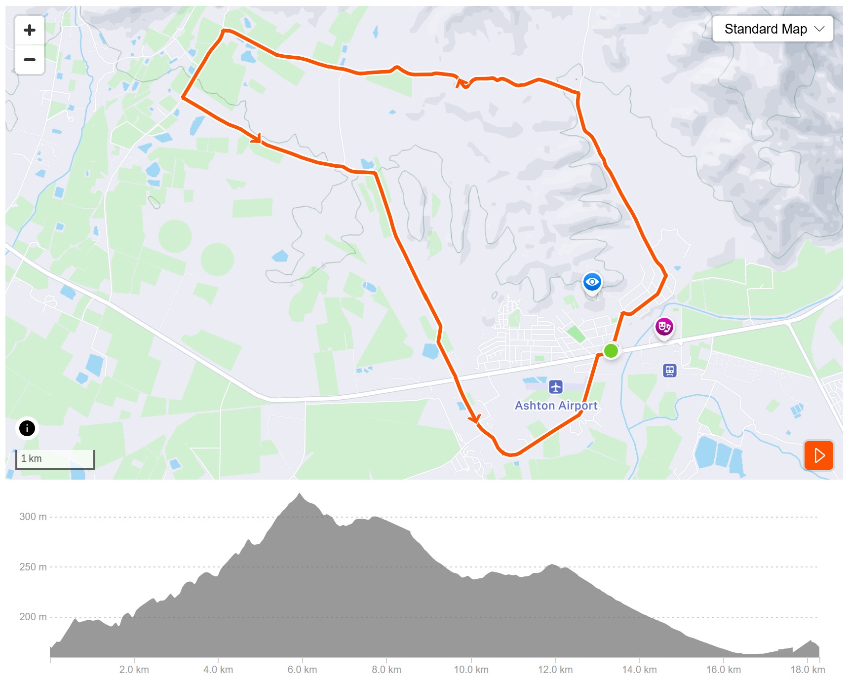
A gentle touring route for a family with a young teen and older, with a few climbs that are rideable for the moderately fit rider.
There is much to see on this route, from 90-year-old vineyards to honey tasting, a cactus nursery, geranium and lavender cordial tasting, olive tasting, as well as plenty of good mountain air.
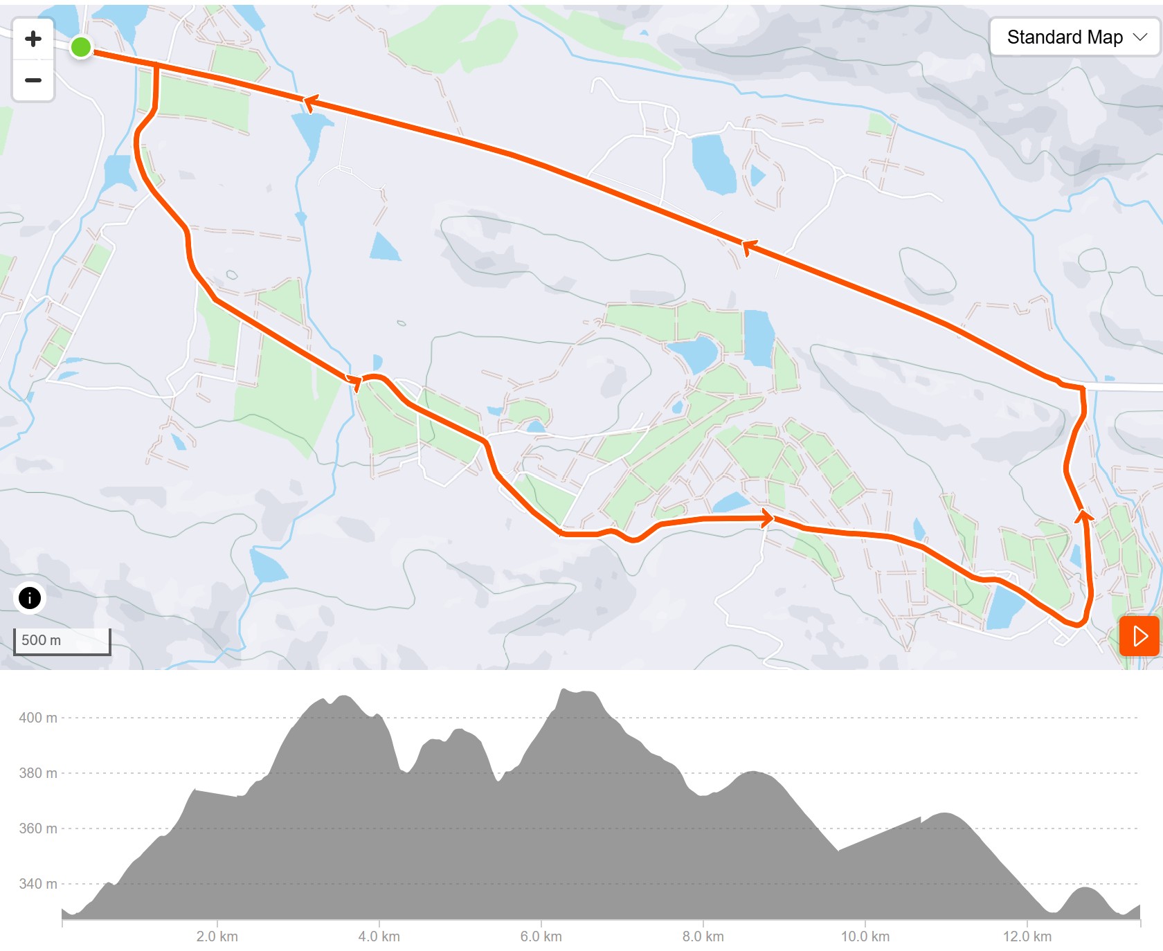
Head out to Barrydale on the R62. Just out of town, there are two small rises which can be taken in one’s stride or pushed a bit to get the heart pumping.
Turn left at 9km or 12km, both have a sign indicating “Rietvlei No 1”. From the turn-off, enjoy a quiet, peaceful ride back to town on good gravel roads and the old Barrydale road.
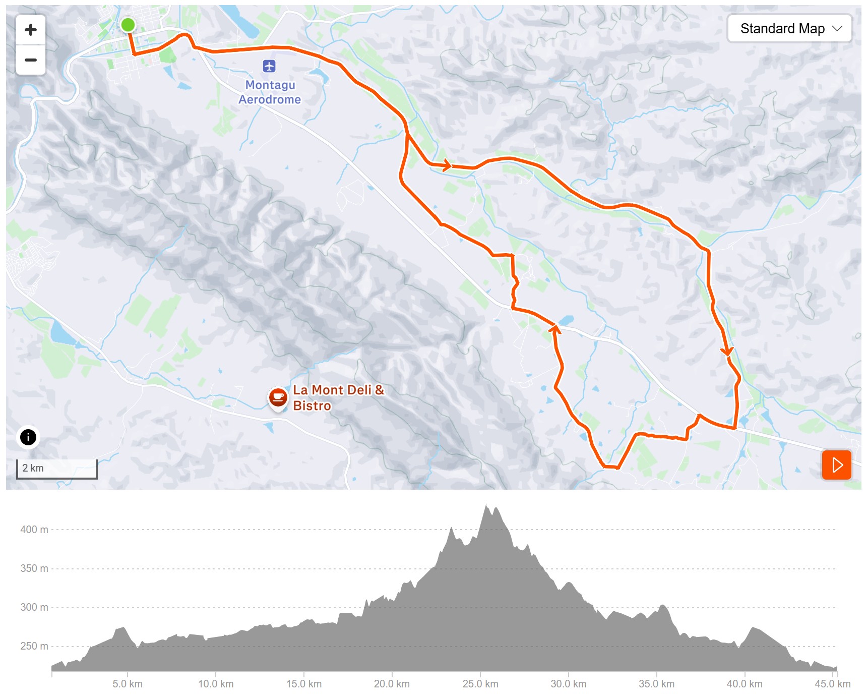
This is a flat and fast route, ideal for families or riders wanting to do a time trial. There are a few rollers once you reach the turn-off to the Poortjieskloof Dam, six of them, in fact, if you want to count them before you reach the R62.
There is a nice rest period for around 6 kilometres before turning back onto the dirt through Rietvlei No 1, and then onto the short section of tar on the narrow old section of the Barrydale Road, before turning onto the Talana Road back to town.
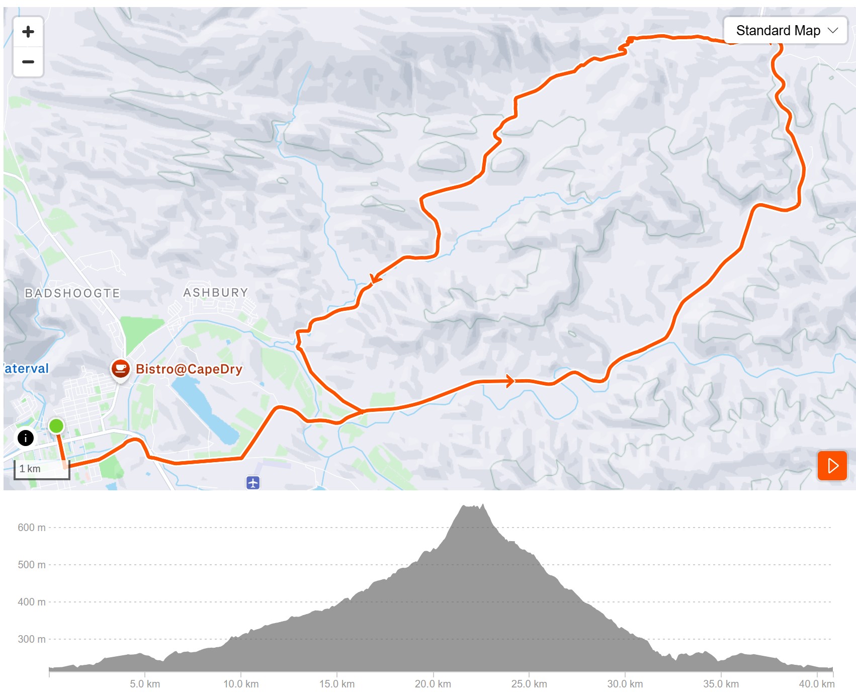
A challenging route of about 42km for the average rider, with a long climb from town to the summit of the Jeep Track. Please close the gate once you are through. A stop at the summit is a must to take in one of my favourite views of the Langeberg.
Caution is required on the descent, as the drop-down has about ten water runoff humps. Once you are through the nursery, it’s a fast drop back home.
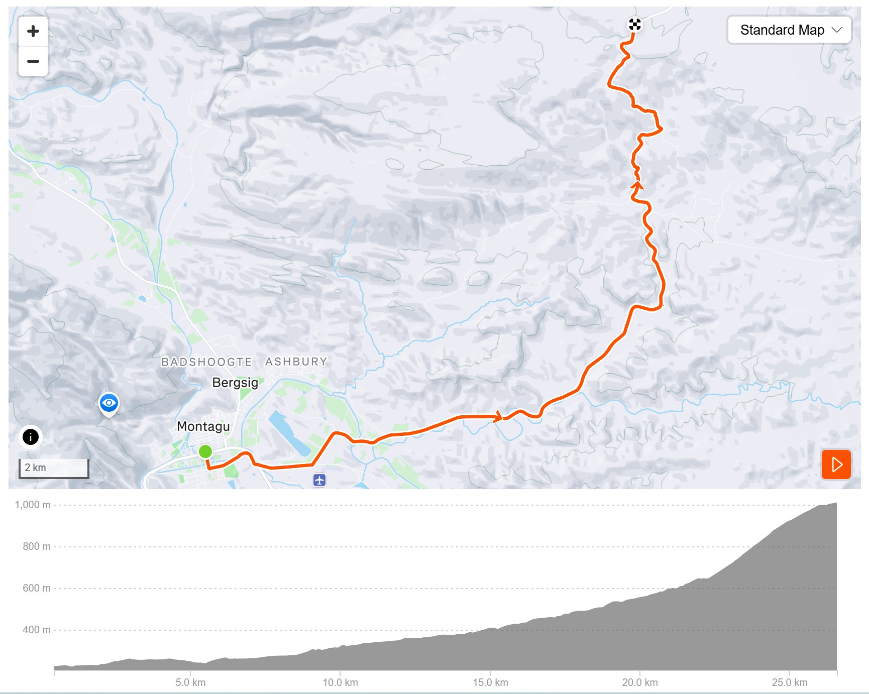
This is the ride for the hard-core rider wanting to get in that much-required hill training. It is a good idea to use a Camelbak for this one. The return trip is fast, and caution is required on the descent down the Ouberg Pass with sharp corners and plenty of washboard surface.
Distance is around 52 kilometres, depending on your route back to town. It contains 38 bends, corners, and curves within its 7.8 km length, with an altitude variance of 497 m, producing an average gradient of under 1:16.
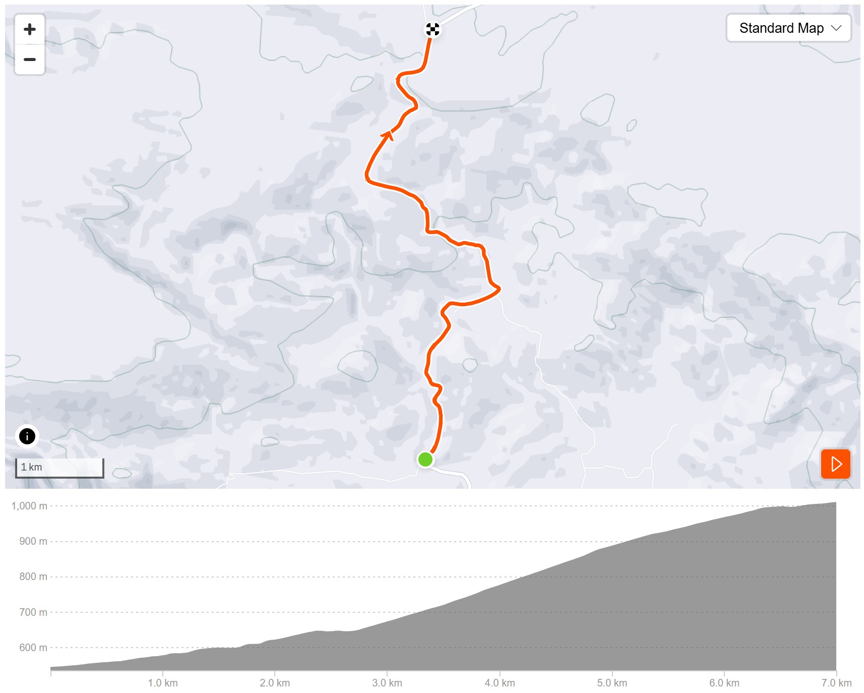
This is the ride for the hard-core rider wanting to get in that much-required hill training. This route is an extension from the Joubert’s Pass turnoff. Distance up and down is 14 km in total.
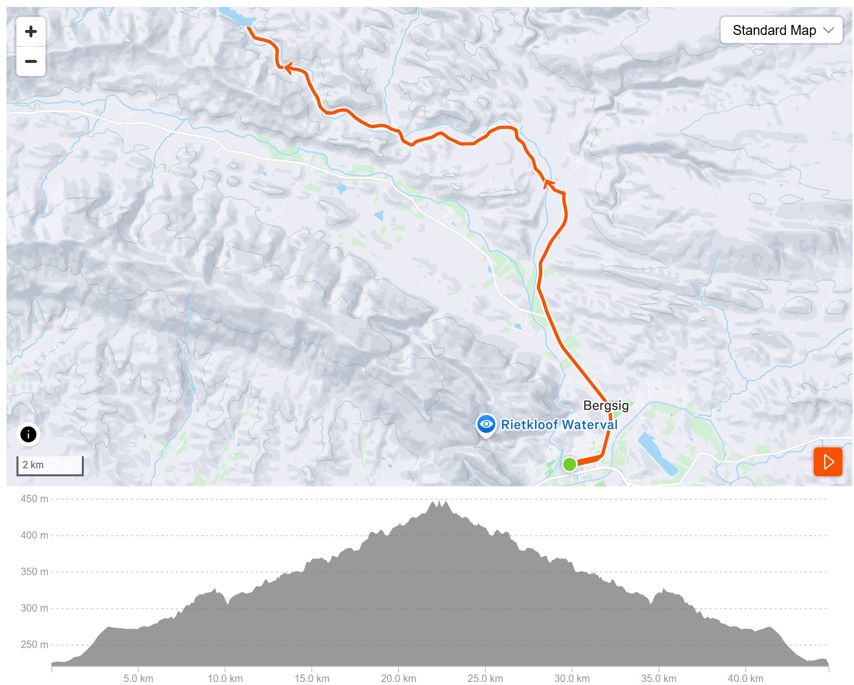
A ride suited for both the average rider and the hard-core racing snake. Flat for the most part. When you reach the T-junction, turn left if you want the short option. Turn right to continue towards the Dam Route, half a kilometre further, turn left and follow the road to the dam.
There is a compulsory portage as you climb the steps on the right or left-hand side of the Pietersfontein Dam without your bike as it is all about the view and taking in the beauty of Langeberg. Count the steps. Depending on whether you go out to the dam and which return route you use, you can stretch this ride to a good 53-kilometre training ride.
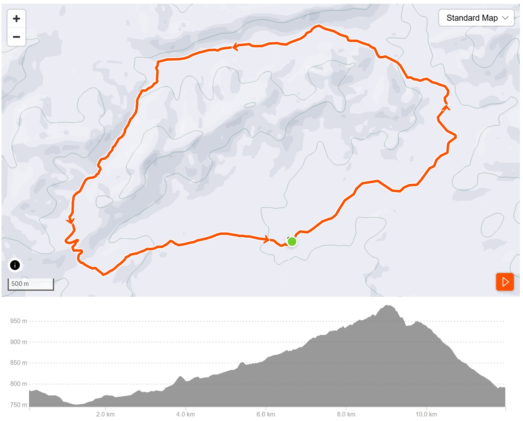
Start and Finish at the Reception Area of African Game Lodge – Anti-clockwise circular trail. The walking time approximately 3 hrs & MTB cycling time approximately 1 hr.
Start – 3.3km good gravel road
3.3 – 6.5km Good jeep track, single track with short challenging sections. Gentle climb.
6.6 – 9.0km Trail through the Slagkloof. Beautiful scenery. Some short challenging sections.
9.00km From the summit, the views are stunning. From Montagu in the west to the distant cottages of AGL.
9.00-12.00 Lovely downhill sections which lead you back to the Reception area
Yes. A trail permit is required to access and help maintain the Montagu Trails network.
Permit fees contribute towards trail development, maintenance, signage, and conservation efforts managed by the non-profit organisation responsible for the trails. Riders should ensure they have a valid permit before using the trail network.
Absolutely. Montagu Trails includes several beginner-friendly routes graded 1 out of 5 for difficulty. The Orange and Green Singletrack routes are ideal for families, casual riders, and those new to mountain biking. These trails feature relatively smooth surfaces, gentle gradients, and well-marked routes that allow riders to enjoy the scenery without tackling highly technical terrain.
Montagu is a year-round cycling destination thanks to its generally dry climate and abundant sunshine. Spring (September to November) and autumn (March to May) offer particularly pleasant riding conditions with moderate temperatures.
During summer, early morning rides are recommended to avoid the midday heat. Winter can also provide excellent riding conditions, often with clear skies and cooler temperatures.
Many riders enjoy the trails independently, however Montagu Trails recommends riding with a partner whenever possible, especially on longer routes. Some of the training and gravel routes have limited or no cellphone signal, and assistance may not be immediately available in remote areas. Always let someone know your planned route, carry sufficient water, and ensure your bicycle is in good mechanical condition before setting out.
Yes, several Montagu Trails routes are shared-use and open to walkers, trail runners and mountain bikers. These include the Orange, Green, Blue, Bessiekop and Montaview singletrack routes. Users should be mindful of each other and follow trail etiquette for a safe experience.